Physical Subsurface Infrastructure Cross-Section
Flooding Block vs Resilient Twin Block
See the exact underground mechanism: An identical cloudburst floods Block A due to conduit silt buildup and catch basin backwater, while Block B discharges smoothly via functional outfall slope.
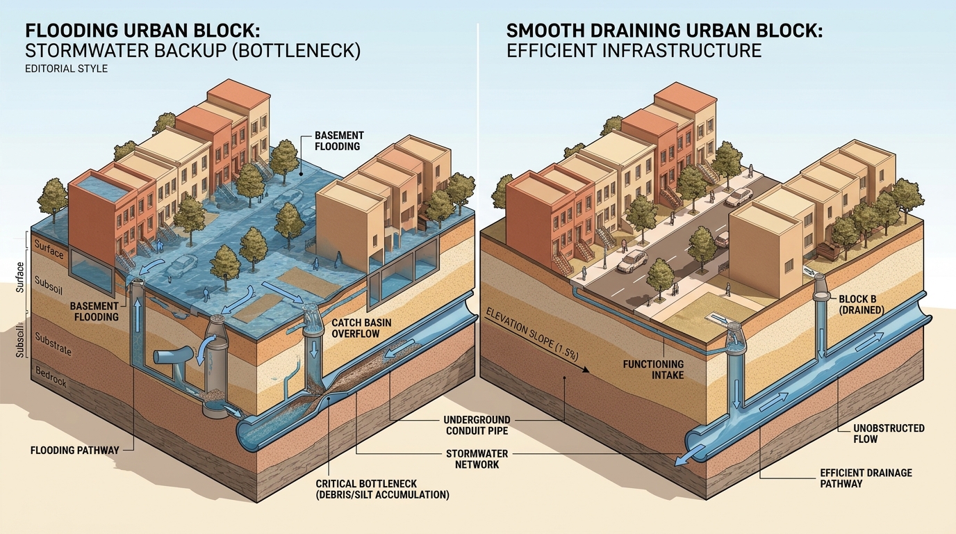
Block A Failure: Stormwater Backup & Siltation
Debris/silt accumulation in underground conduit pipe causes upstream water to push upward through catch basins, flooding streets and basements despite standard rainfall.
Block B Resilience: Unobstructed Gravity Flow
A 1.5% elevation slope coupled with unclogged conduit cross-section allows storm intake to discharge directly to trunk canals without surface ponding.
Topographic Survey & River Systems Datum
Greater Chennai Drainage Basin Grid
Spatial analysis across the three primary river discharge arteries and coastal canal networks.
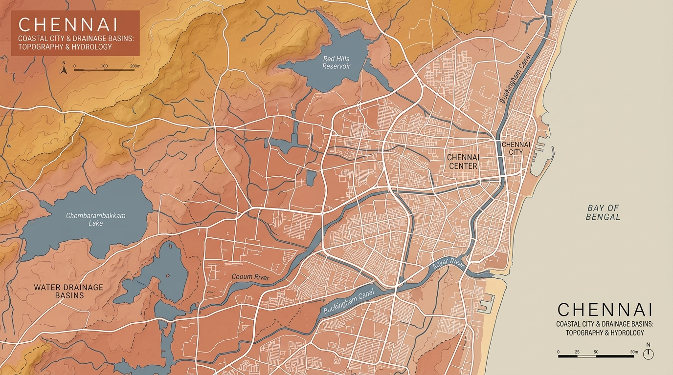
Topographic Survey & Drainage Basin DatumGreater Chennai Corporation Hydrological Grid
Major River Systems: Cooum, Adyar & Buckingham Canal
Reservoirs: Red Hills & Chembarambakkam Lake
Launch Map Investigation →4 Wards
Calibrated Urban Basins
100+
2015 Flood Inundation Markers
6 Vectors
DEM, HAND, SWD, Impervious
<200ms
Causal Formulation Engine